
THIS is the reason I got a boat. To sail the Maine coast!
Here's a rough track of the trip, all mileage numbers are approximate straight-line distances (as the tuna swims?).

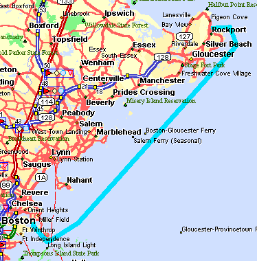 |
Day 1, Saturday Aug. 28, 1998 Winthrop - Rockport, 35 mi. Believe it or not, we weren't sure which way we were going to go, up to Maine or down to Buzzard's Bay, until we left Winthrop and were at the decision point in the Boston Harbor Islands. |
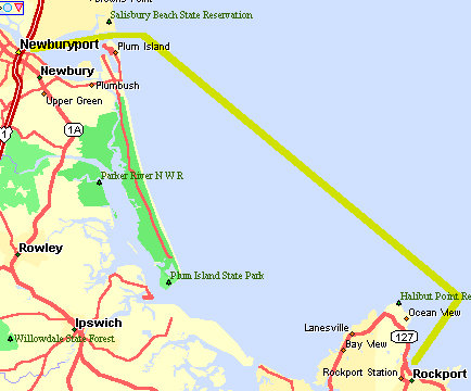 |
Day 2, Sunday Aug. 29 Rockport - Newburyport, 20 mi. Took off as soon as we could to catch the nice breeze, but the breeze vanished as soon as we got outside the harbor. The water was amazingly warm, so we swam around a bit and I took the opportunity to clean the bottom, which hadn't been out of the water for over a year. After removing a skin of algae and piles of mussels, I got out of the water just in time to see a whale swim right by us! I don't know if he was interested in the cloud of algae I'd created, but he got pretty close! Tied up to the town dock overnight, which is tremendously convenient to all the Newburyport fun spots. |
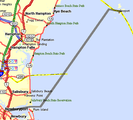 |
Day 3, Monday Aug. 30 Newburyport - Isles of Shoals, 19 mi. |
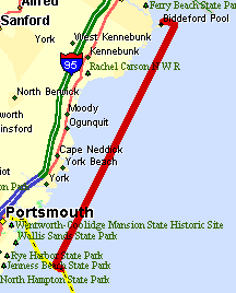 |
Day 4, Tuesday Aug. 31 Isles of Shoals - Biddeford Pool, 38 mi. This was a long day, we tried to make some serious progress since the wind had been less than we'd hoped for the first few days of the trip. We rolled into an anchorage outside the pool after dark, happy to have gotten pretty close to Portland. |
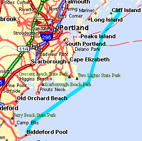 |
Day 5, Wednesday Sept. 1 Biddeford Pool - Cliff Island, 23 mi. I'll admit, I was pretty excited to be sailing into Casco Bay. This is one page of the chart book that I'd been staring at for years. It must have a hundred islands, and I can imagine at least that many ways to sail through them. Don't take my word for it, the Cruising Guide to the Maine Coast has 51 entries for the 12 x 20 mi. Casco Bay area. Coming from New Hampshire, this is where the Maine coast first starts to look like the Maine coast. |
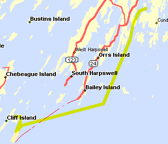 |
Day 6, Thursday Sept. 2 Cliff / Jewell Island - Snow Island, 16 mi. Motored over to Jewell I. and took a quick walk around before we headed to Snow Island. Snow I. is wonderfully hidden in a small cove with only a narrow inlet. Lots of Osprey around! |
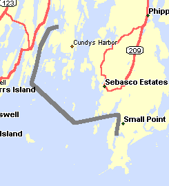 |
Day 7, Friday Sept. 3 Snow Island - Cape Small, mi. Rowed the dinghy around Snow I. in the AM, looking at all the Osprey nests in the trees, and wondering at the frantic activity of a school of fish that must have been chased into this small bay. Getting into Cape Small Harbor is quite interesting, we're lucky QT only draws about 2.5'. At low tide our anchorage didn't have much more than that! For dinner we rowed the dinghy across the harbor to a lobster shack, and were very lucky that there was enough water left to get back when we were done. |
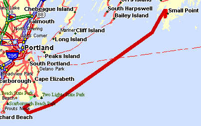 |
Day 8, Saturday Sept. 4 Cape Small - Richmond Island, 28 mi. Quite a challenge to get out of the harbor as the tide was falling, but with a little advice from someone going the other way we got out OK. Be careful getting by Goose Rks., or better yet, go through on a rising tide. This was the first day we saw any fog, but it wasn't too bad. It came back in as we went by Cape Elizabeth, so we headed in for the night behind Richmond I., which is easy to find and doesn't have any surprises on the approach. |
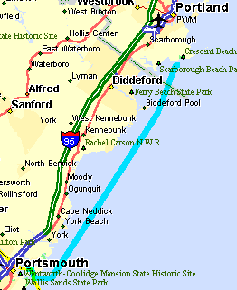 |
Day 9, Sunday Sept. 5 Richmond Island - Portsmouth, 45 mi. Again, nice during the day but foggy when we got close to our objective. The marina near the Coast Guard station offered us "any of the bright orange moorings." We picked up the first unoccupied non-white mooring we could see through the fog, but it turned out that was not one of the rental moorings. |
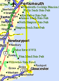 |
Day 10, Monday Sept. 6 Portsmouth - Gloucester, 35 mi. Rather foggy leaving Portsmouth, but it cleared when we got out into open water. Nice cruise through the Annisquam river at sunset, but it did start to rain on us a bit. This was the first and only rain of the trip, not bad! |
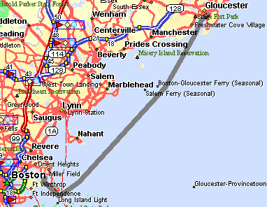 |
Day 11, Tuesday Sept. 7 Gloucester - Winthrop, 27 mi. Home again. |